The European Union's eastern land border is thousands of kilometres long, but you can only cross it legally at a limited set of places: the border crossing points. Everything between them is closed frontier. That makes the crossings the true geography of the line - the points where roads, railways and rivers were allowed to keep going. This page walks the line from north to south, crossing by crossing.
What counts as a crossing point
A border crossing point is the authorised place where people and goods may pass an external border - by road, by rail or, on the big rivers, by ferry and port. Between crossings lies what officials call the green border: forest, marsh, field and water where crossing is prohibited. Crossings are not distributed evenly. They sit where geography and history put them - at bridgeheads, mountain passes and the old trade roads that predate every current boundary.
North: the Baltic approaches
The line begins in Lapland, at the point where Finland, Norway and Russia meet, and runs south through taiga and lake country along the Finnish-Russian border - at roughly 1,300 kilometres the longest single section any EU state shares with Russia. South of the Gulf of Finland the frontier resumes at Narva, where the bridge between Estonia and Russia crosses the Narva river beneath two medieval fortresses that have faced each other for five centuries.
In Latvia the main road crossing to Russia is Terehova, on the highway that has connected Riga and Moscow since tsarist times. Lithuania's frontier faces Belarus; its best-known road crossing, Medininkai, sits on the old Vilnius-Minsk road barely half an hour from the Lithuanian capital.
Centre: the Bug line and the Carpathian gates
Poland's eastern border follows the Bug river for long stretches - a slow lowland river that became one of Europe's most consequential lines. The Warsaw-Minsk road and rail corridor crosses to Belarus at Terespol, opposite the Belarusian fortress city of Brest. Further south, the busiest Polish-Ukrainian road crossing is Medyka, a few kilometres from the old garrison town of Przemysl.
Below Poland the border climbs into the wooded ridges of the Carpathians. Crossings here are few - the mountains see to that. Slovakia's main gate to Ukraine is Vysne Nemecke, on the road to Uzhhorod, where the frontier drops out of the hills onto the edge of the Pannonian plain.
South: the Tisza, the Prut and the road to Istanbul
Hungary meets Ukraine on the Tisza river at Zahony - a modest town with an outsized rail yard, because here the European standard-gauge network meets the broader gauge inherited from the Soviet railways, and freight must be transshipped or re-bogied. Romania's border with Moldova is a river border from end to end: the Prut, crossed by a chain of bridge crossings between the two countries. At the Black Sea end of the line, the Danube and its delta separate Romania from Ukraine in a landscape of reeds and channels with almost no fixed crossings at all.
The final stretch belongs to Bulgaria and Greece. Bulgaria's Kapitan Andreevo, outside Svilengrad, stands on the ancient road from central Europe to Istanbul and handles a huge share of the EU's road traffic with Turkey. A short distance south, the Greek-Turkish border follows the Evros river (the Maritsa, upstream in Bulgaria) down to the Aegean, with the road crossing at Kipoi closing the line's five-thousand-kilometre journey from the Arctic.
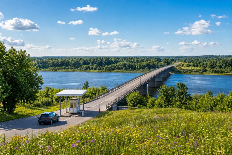
Almost every major crossing on the line is a river crossing or sits within sight of one. Rivers made natural boundaries, and bridges made natural gates - the crossings simply inherited both.
Why the crossings are where they are
Nothing about this map is accidental. Narva, Terespol and Kapitan Andreevo all guard river bridgeheads on roads that are centuries older than the states around them. Medininkai and Terehova sit on imperial post roads. Zahony exists because two railway systems with different track gauges had to meet somewhere. When a border moves, the crossings usually stay - geography outlasts politics. What changes is what happens at the line: the checks, the queues and the paperwork, which are covered in the article on customs cooperation along this frontier, and the towns and landscapes around the crossings, covered in life along the border. For seeing the line with your own eyes, start with the field notes on visiting the frontier.